Historic Yellow-rumped Warbler flight eclipses previous spring maxima from the New England Coast
Introduction
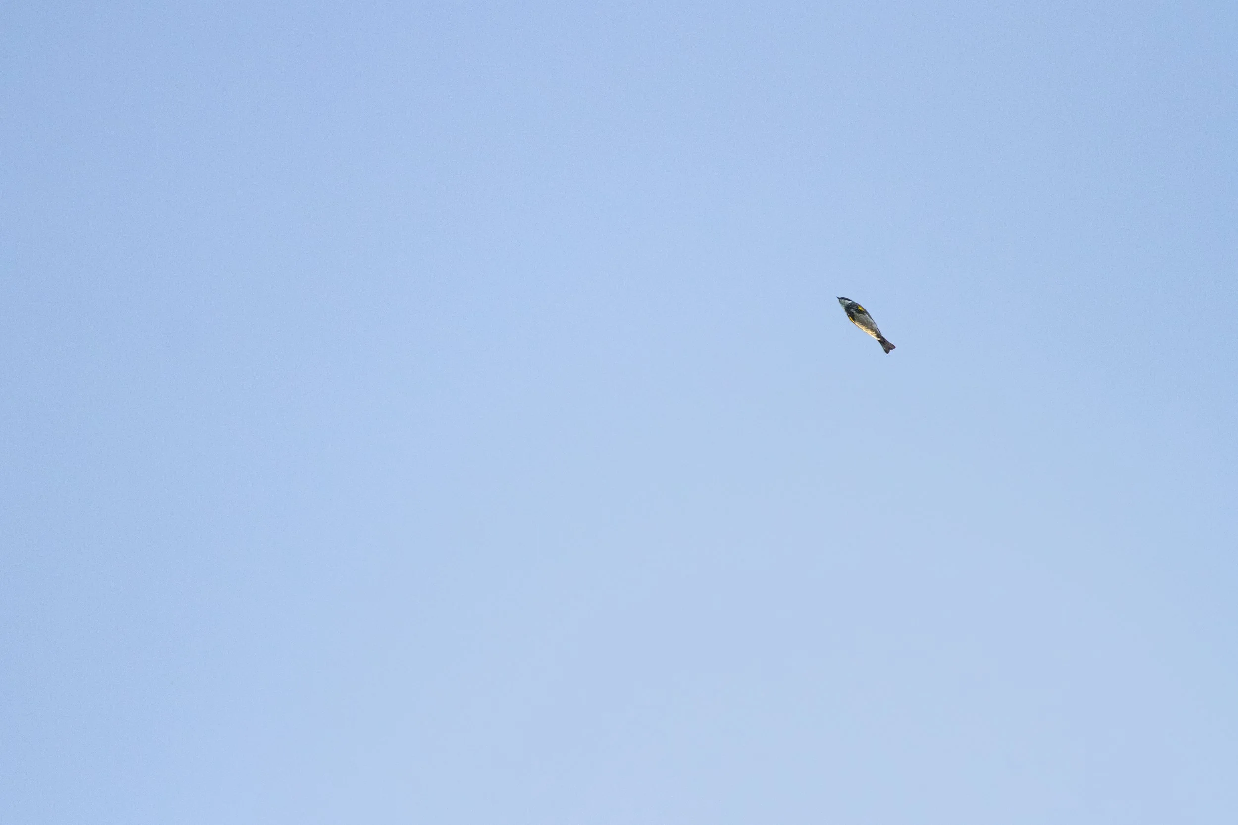
I stood watch this morning as an immense flight of 4,450 yellow-rumped warblers streamed northwest over Great Neck and Plum Island Sound. This figure eclipses prior spring maxima from the New England coast and, more notably, many of the regional maxima from the fall season when a higher number of birds returns south after reproducing across the boreal and northern temperate forests (Vickery et al., 2020; Keith and Fox, 2013; Veit and Petersen, 1999; Berry, 2024; Ferren et al., 2024; Zeranksi and Baptist, 1990; eBird). This spectacle effectively erased my growing doubts that highly concentrated morning flights can be observed away from Plum Island within the Ipswich saltmarsh-drumlin-barrier beach system, and sheds light on how birds reorient across the Great Marsh and Cape Ann following offshore displacement during the nocturnal migration period.
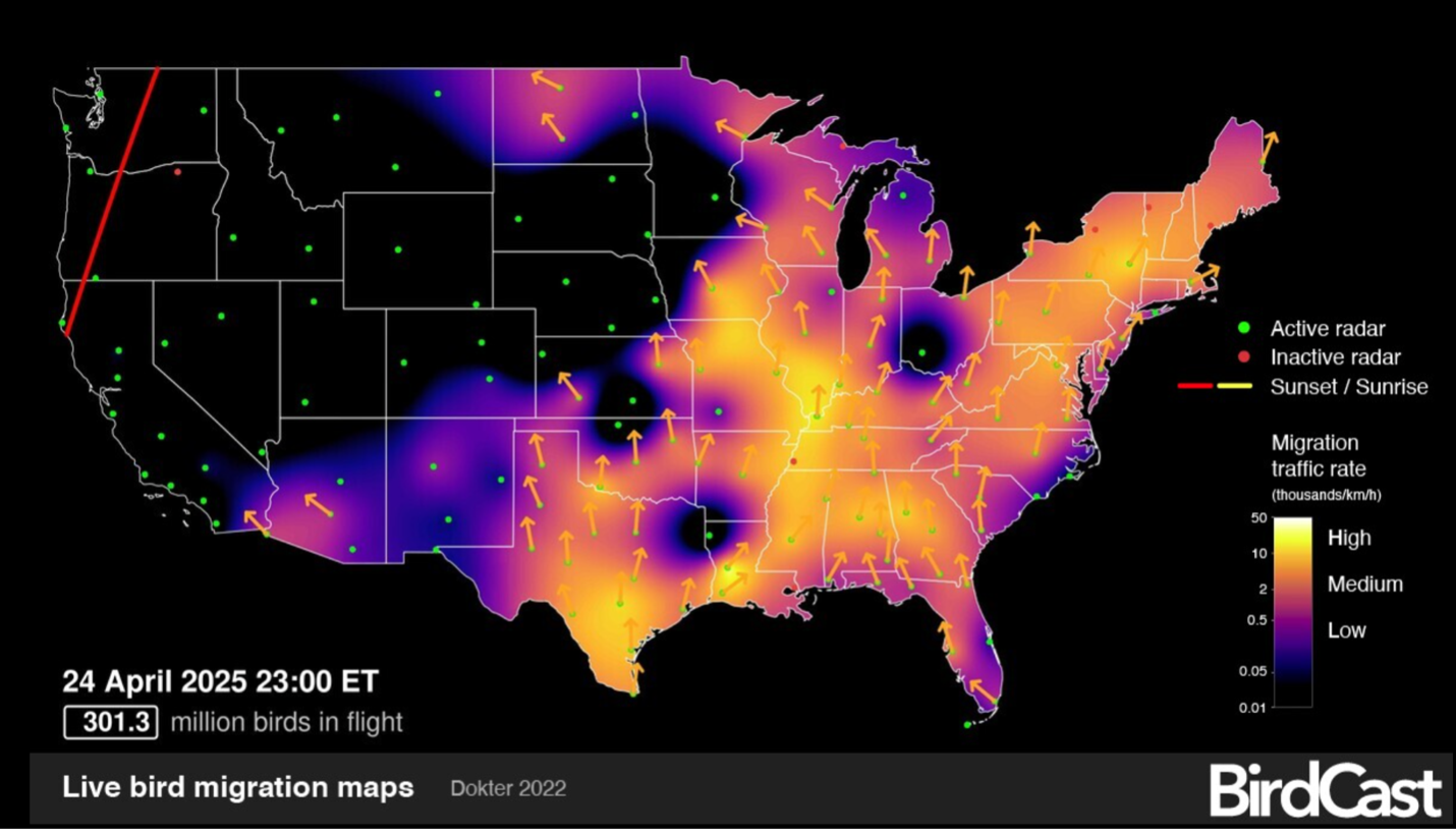
What conditions led to the extreme locality of this flight? What caused such quantities of birds to move through such a narrow geographical area? A nationwide glitch in the NEXRAD system just before midnight brought BirdCast to an abrupt halt, leaving only weather data and fragmented segments of radar imagery to reconstruct the nocturnal migration preceding this remarkable flight.
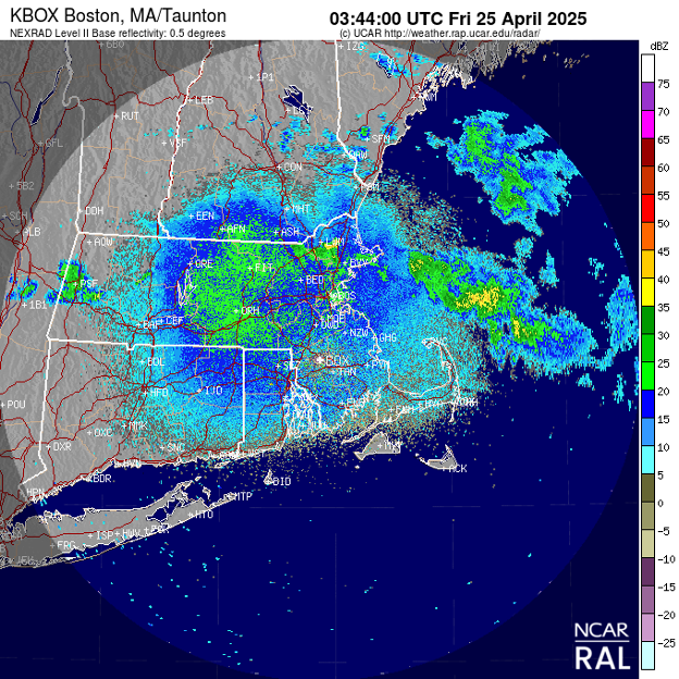
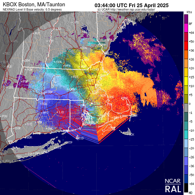
A basic understanding of base reflectivity and base velocity radar will help readers to better comprehend the images included below. Base reflectivity depicts circular blue and green features that represent migrating birds; precipitation appears as irregular bands. Base velocity images resemble a rainbow pin wheel; positive base velocity values represent targets moving away from the radar and are shown in warmer colors (red, orange, yellow, etc.), and those moving toward the radar are shown in cooler colors (blue, green, purple, etc.). Additionally, each radar image capture is labelled in Coordinated Universal Time (UTC) or 5 hours ahead of Eastern Standard Time (EST). ‘How to Be a Better Birder’ by Derek Lovitch includes an excellent introduction to using radar to observe bird migration.
The Setup
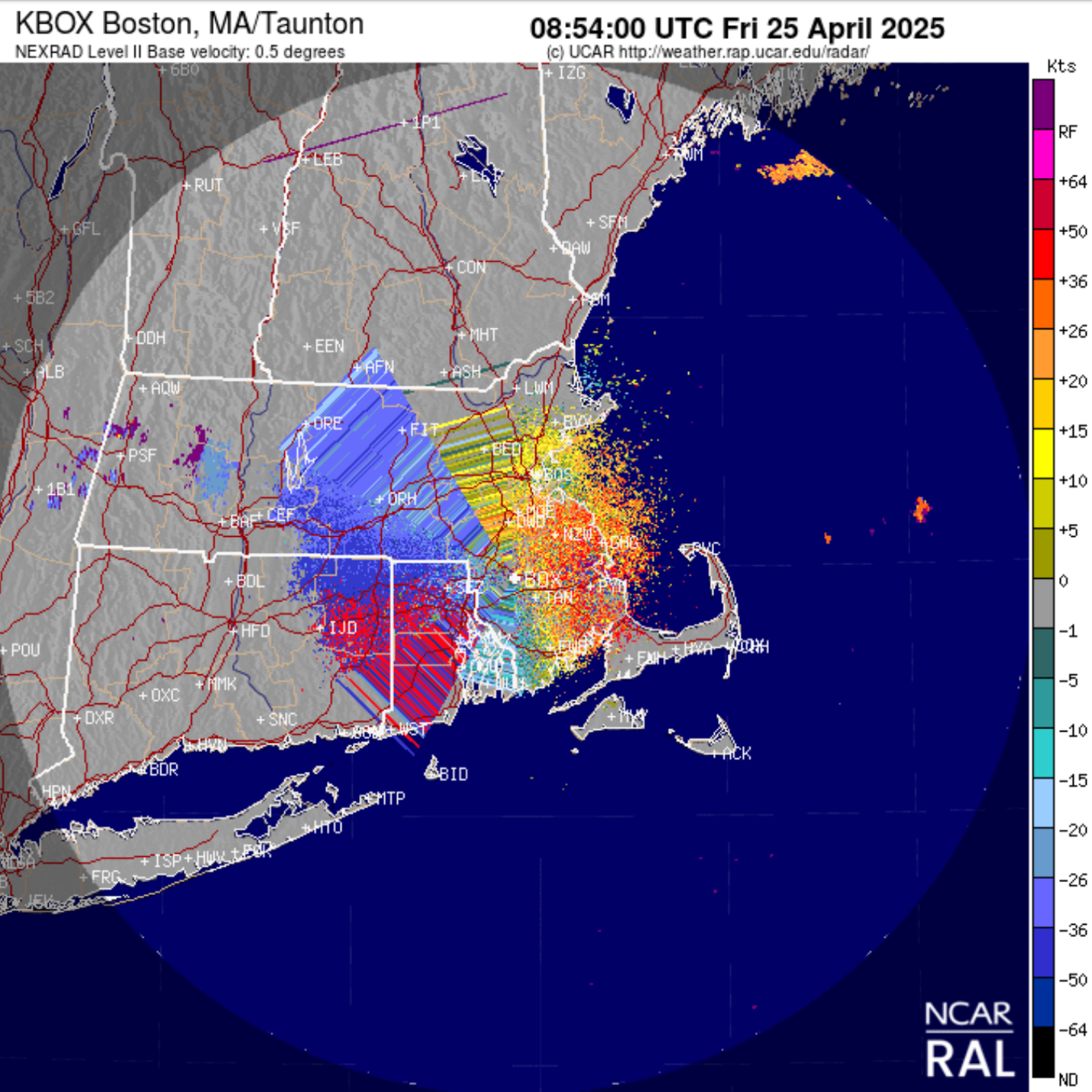
As high pressure drifted offshore across New England and the Mid-Atlantic on Thursday evening, favorable migration conditions developed to spur medium to high migration traffic rates across the region. Movement along the coast of Massachusetts was characterized by a strong east-northeast component. This trajectory coincided with a localized band of 30 to 40 mph westerlies occurring at 2,000 ft—the same altitude at which birds were migrating—along a slow-moving stationary frontal boundary (despite the name, stationary fronts can move slowly). Birdcast managed to document this rapid east-northeast trajectory of migrating birds prior to the glitch.
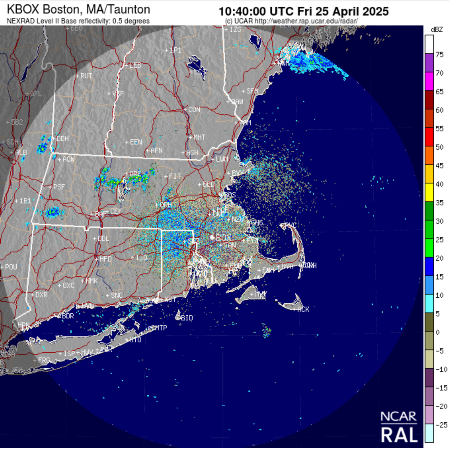
At the same time, a weak system tracking southeast across New England delivered scattered showers along the coast from southern Maine to Cape Cod precisely as birds began to migrate in the 90-minute window after sunset, though these showers did not appear to significantly halt migration, and birds continued to move between bands of precipitation. As migration reached its peak intensity around 10:30 pm, a narrow band of moderate precipitation tracked southeast across Essex County. Locally heavy precipitation passed over central Essex County, Cape Ann and eventually Massachusetts Bay. By this point in the evening the number of birds aloft over coastal Massachusetts had reached its peak, including large concentrations which had drifted over Cape Cod Bay, Massachusetts Bay and Ipswich Bay throughout the course of the migration period. These birds, displaced over the ocean, would be forced to remain volant upon encountering precipitation.
In an unfortunate turn of events, the NEXRAD system glitch occurred immediately after birds aloft over offshore Essex County and Massachusetts Bay encountered this band of precipitation, but clues remained in the uncorrupted imagery that followed suite.
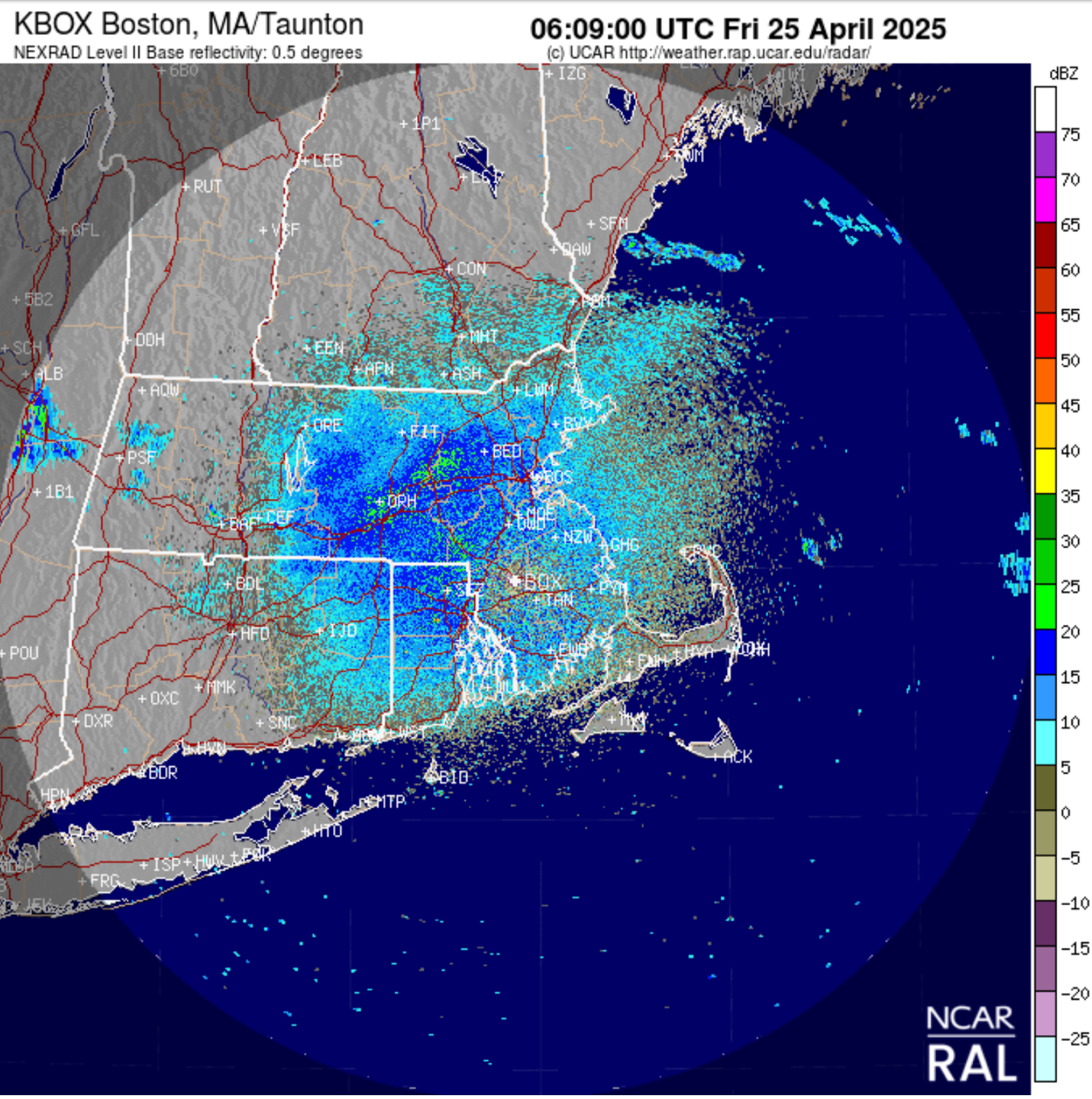
The final uncorrupted base reflectivity image captured at 10:44 pm on Thursday evening reveals an intense starburst pattern over Massachusetts signifying high migration traffic of airborne birds. Significant concentrations of birds are similarly present offshore.
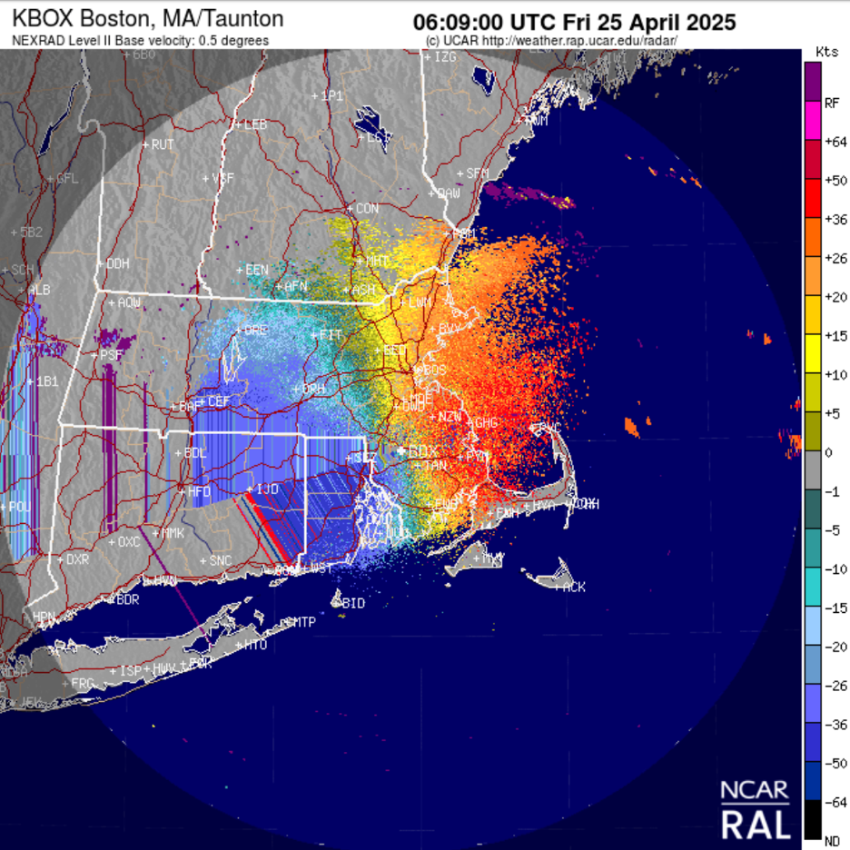
Base velocity reveals a continued east-northeast component of movements occurring offshore that coincide with the arrival of precipitation. Note the particularly high velocity of birds traveling at 40+ mph over Cape Cod Bay, where locally strong westerlies at 2,000 feet were blowing along the frontal boundary. These strong westerlies at migration altitude are largely responsible for the east-northeast flight direction and resulting high numbers of migrating birds displaced over the ocean.
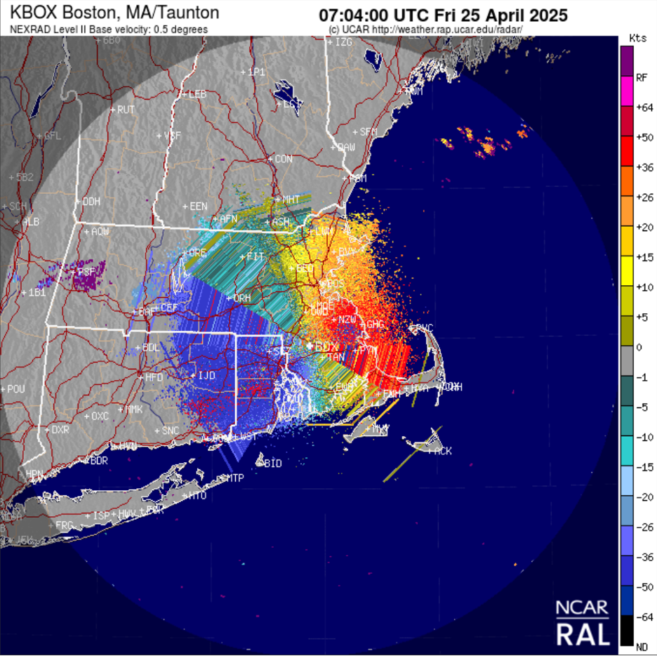
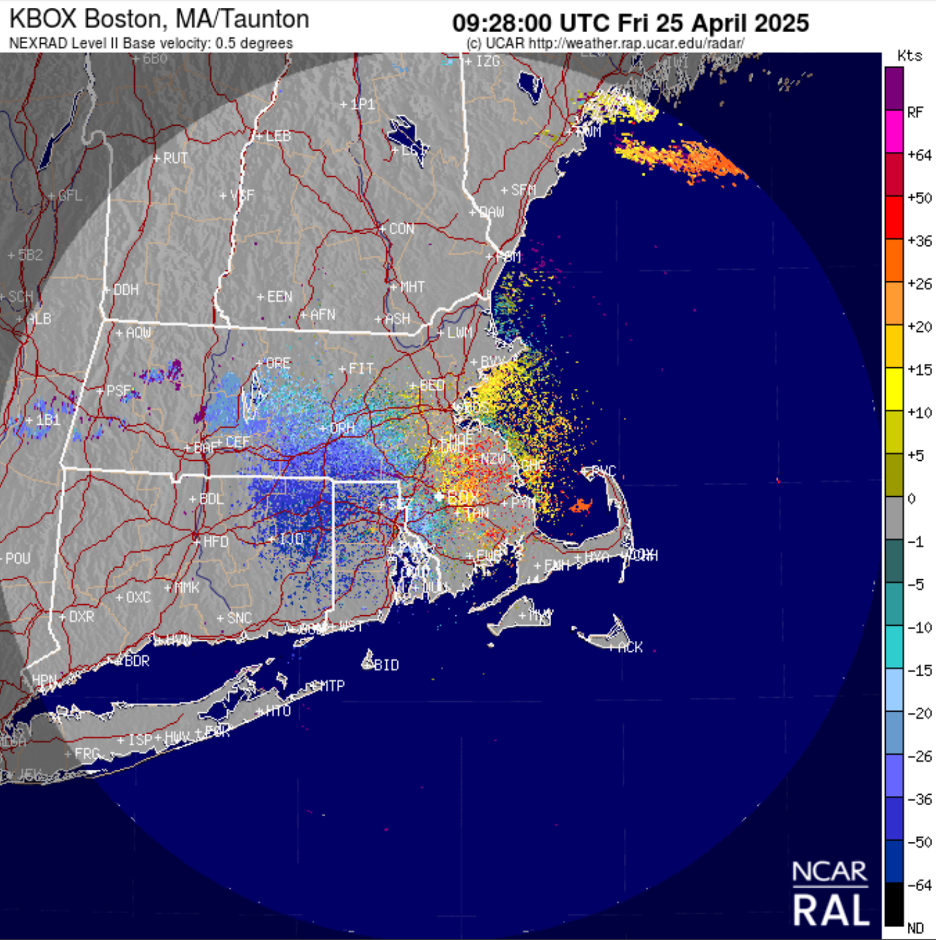
The next unaffected radar image was recorded 2.5 hours later at 1:09 am on Friday. Base reflectivity reveals a notable reduction in migration intensity as birds over the mainland begin to descend. Conversely, concentrations of birds displaced offshore with nowhere to land were forced to remain volant. Base velocity reveals the continued east-northeast directionality as these displaced birds remained in the air.
This account has thus far focused on flight dynamics at the regional scale and will now shift to a more localized focus on coastal Essex County.
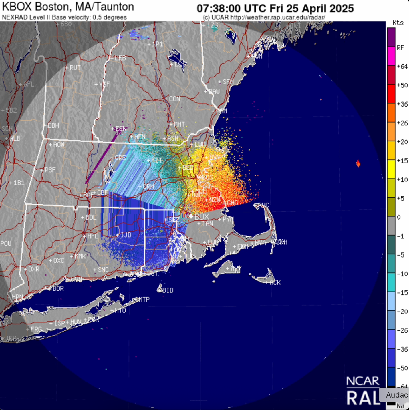
The final image depicting a uniform east-northeast component over coastal Massachusetts and the offshore waters of Essex County occurred at 2:04 am.
At 2:38 am, a stippled pattern of blue dots over Ipswich Bay on base velocity radar suggest that the first reorientation flights are beginning to occur. That is, rather than continue their migrations east-northeast, birds begin to reorient towards the nearest point of land. In the case of birds over Ipswich Bay, this was either Plum Island or the northwest coast of Cape Ann. Interestingly, this reorientation commences before astronomical twilight.
Reorientation becomes increasingly apparent after the onset of astronomical twilight. A partially uncorrupted radar image captured at 3:54 am further reflects the reorientation of birds aloft over Ipswich Bay moving toward the coast between the Plum Island and the northwest coast of Cape Ann. Notably, the only other sign of reorientation occurring at this time is shown in the stippled blue pattern over the Boston Harbor Islands and westernmost reaches of Massachusetts Bay; birds over outer Massachusetts Bay appear to continue roughly northeast at this time.
This pattern continues consistently throughout the duration of astronomical twilight, with birds aloft over Ipswich Bay moving in the direction of the New Hampshire coast, Salisbury and Plum Island, or south towards Cape Ann.
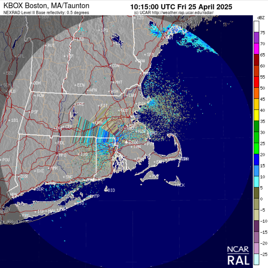
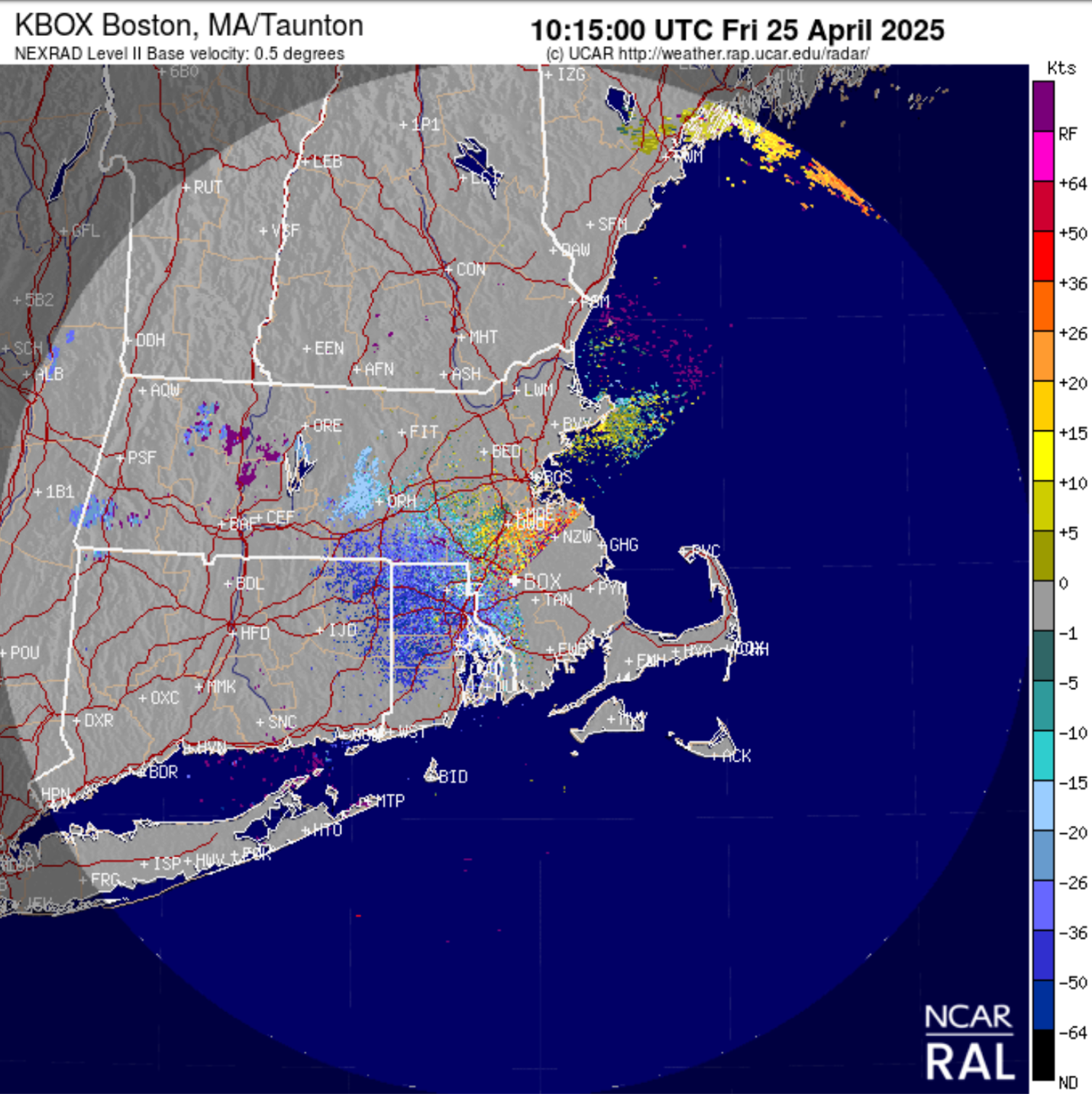
At civil twilight, or ‘first light’, the real excitement begins. Radar reveals a mass of birds over the water immediately southeast of Cape Ann.
Switching the same radar image to base velocity, a near-zero reading is reflected by this mass of birds. When birds pass tangentially to the radar, it results in a no-speed reading represented in gray (in this particular case the reading is gray-green and corresponds to near-zero readings that are predominately positive, though negative readings are reflected by birds arriving from farther to the northeast), because they are neither flying toward or away from the radar station. This near-zero gray-green reading therefore indicates that these birds followed a predominantly northwest trajectory towards the eastern headlands of Cape Ann. It is conceivable that the comparatively smaller quantity of birds which encountered themselves over Ipswich Bay at daybreak joined the west-northwest flight line away from Cape Ann after reorienting away from Ipswich Bay and towards the northwest coast of Cape Ann. In short, thousands of birds were pouring towards Cape Ann from offshore at daybreak.
11 minutes later, the picture is complete. As birds arrive at Cape Ann via the eastern and, to a lesser extent, the northwest headlands, they engage in a west-northwest reorientation along the coastline and funnel through Plum Island Sound, bypassing an alternative north-northwest flight line along Plum Island. Various experienced birders reported unremarkable tallies of YRWA (≤ 85 individuals) on Plum Island the morning of 25 April, effectively contributing to a collaborative groundtruthing effort that would further support the extreme locality of the flight line passing over eastern Ipswich.
Historical Significance
The tally of YRWA observed this morning eclipses all previous documented Massachusetts maxima (cf 1350 on 29 April 2003 by Rick Heil on Plum Island); all previous Maine maxima (cf 3190 on 14 October 2023 on Monhegan Island by J. Trimble, Maili Waters, L. Seitz, et al.; 400 on 6 May 2006 in W. Falmouth by Luke Seitz); all previous New Hampshire maxima (cf 1964 on 19 October 2014 by Steve Mirick in Hampton); all previous Rhode Island maxima (cf 4360 on 13 October 2021 by Sam Miller on Block Island); all previous Connecticut spring maxima.
Closing Thoughts
As I watched a nearly incessant stream of thousands of warblers pass over me, I prioritized documentation and quantification but also made sure to take time, albeit brief moments, to appreciate the spectacle unfolding in front of me. Not only was I awestruck by sheer quantity of birds overhead, but I was beaming as I watched it happen five minutes from home in the very place I had hoped to encounter something like this all along. I have spent nearly a decade trying to successfully pin down a concentrated morning flight of passerines in the saltmarsh-drumlin-barrier beach complex of Ipswich. Today was the culmination of years of hard work and serves as a reminder not only to the wonder of bird migration, but to the abundance that remains to be found in our own backyards.